ODP Site Map Poster
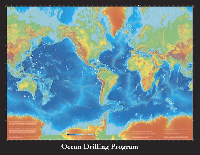
This map is based on a color-shaded relief map produced by the National Oceanic and Atmospheric Administration (NOAA) National Centers for Environmental Information (NEIC, previously NGDC). The following text explaining the history of the program is included on the poster.
THE OCEAN DRILLING PROGRAM (ODP; 1985–2003) was an international partnership of scientists and research institutions organized to study the evolution and structure of the Earth through continuous coring and drilling using new tools and measurement systems. During the program, the dynamically positioned drillship JOIDES Resolution traveled 355,781 nautical miles to obtain cores of sediments and rock that preserve Earth’s history. A total of 35,772 cores from 669 sites in all the world's oceans were collected during the program and are still used for interdisciplinary scientific research. Research conducted during ODP produced fundamentally new information on topics ranging from rapid and extreme changes in the Earth’s climate to frozen methane hydrates linked to the global carbon cycle to earthquakes associated with subduction zones to microbes living beneath the seafloor. Operations were led by the Joint Oceanographic Institutions, Texas A&M University, and Lamont-Doherty Earth Observatory of Columbia University and guided by an international science advisory structure. More than 20 nations led this endeavor, which was funded principally by the U.S. National Science Foundation (NSF).
Download 46 × 35 inch poster (PDF; 8 Mb)
For additional information on scientific ocean drilling, please contact:
JRSO Science ServicesTexas A&M University
1000 Discovery Drive
College Station TX 77845
USA
information@iodp.tamu.edu
http://iodp.tamu.edu/
Tel: (979) 845-2673